Part 1: From San Francisco to Silverdale.
Part 2: From Silverdale to San Francisco.
Remember to watch the video of this trip: Solar Eclipse 2017
Part 2: From Silverdale to San Francisco

Packwood, WA, August 2017
We left Silverdale in the morning and headed southeast. In Packwood southeast of Seattle we stopped as this village was the best place to view the mighty volcano Mt. Rainier - according to McBear' studies on Google Streetview. But, no, there were clouds as expected.
At 4,300 meter Mt. Rainier is perhaps the tallest of all the US volcanos and it was the last on our list of volcanos to see.
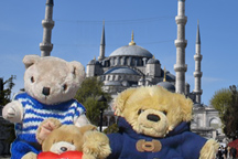
Click each photo to enlarge

In Yakima in eastern Washington we stayed one night before we entered Oregon from north and later arrived Ontario.

Ontario, Oregon, August 2017
Our basecamp for the solar eclipse would be the Holiday Inn.
Before the trip McBear had been studying where the shadow of the Moon
would travel across America - the socalled line of totality - and Ontario
was right on the line! Later, McBear learned that the line of
totality was expected to be a bit further to the north. And our
humans had paid a severely expensive bill for our room...

We had planned to set up our scientific equipment in the car park at the hotel, however, the line of totality was now expected to go through Weiser, a small town across the Snake River just inside the border of Idaho. So, the next morning we went to Weiser.

Weiser, Idaho, August 2017
To avoid trafic congestion and over crowded streets, the city council of Weiser had arranged for some fields to be cleared so people could park and watch the solar eclipse. We parked and set up our gear. Wow, it was getting very exciting...

Now, we were all waiting on the time to pass until 11.20...

Weiser, Idaho, August 2017
Slowly the light from the Sun started to dim. This was the transition, when the Moon covered only a part of the Sun and still it was all bright. But then, at 11.20 as predicted, everything darkened! Wow. People around were cheering. The bears were excited while recording the event.

After a bit more than 2 minutes the light slowly started to come back. Then it was all over and we started to head back. Leaving Weiser, we could see why there had been warnings of trafic congestion: ahead of us was a long line of cars stretching for ... maybe a mile!

Ontario, Oregon, August 2017
It was the next morning, just after breakfast, that we heard
Roger yelling and calling us from the bathroom. We rushed out to
see what was going on. Roger was standing on top of the bath tub
and he looked severy grumpy.
"Now, WHO used the last of the shampoo without notifying
the rest of us? Now I'll have a sticky fur all day until
we arrive our next hotel tonight!

We left Ontario and headed to Caldwell near Boise in Idaho - it was
the nearest town with a Starbucks that McBear could find on
Google Maps. After Caldwell we followed the Highway
95 which took us back across the border to Oregon.
"Did you see that road sign?" Roger asked McBear.
"It said 'Chicken Dinner Road'!" Roger was laughing.
"Damn," said McBear. "I didn't see it and I didn't get a photo!"

Rome, Oregon, August 2017
We stopped in Rome to refuel. McBear was nearly gobsmacked to discover their old fuel pumps and that the shop owner, a lady, filled up the car for customers.

From Oregon we entered McDermitt, a small town inside the border of Nevada.

We went south and arrived the Best Western in Winnemucca. The town got its name from a clever Indian squaw who learned English and worked as an translator between her tribe and the US military in the 1800s. Many places around the town Winnemucca's name was honored.

Winnemucca, August 2017
We went around Winnemucca to explore. McBear got all excited as
we reached an old part of town with many old car wrecks.
"Wow! Imagine we could restore this fine old air ship and cruise
America!"

We left Winnemucca the next day and cruised south west on the Interstate 80. Many places we could see what looked to be sand areas but was actually the lake bed from dry saltwater lakes and even seas! Many are visible on the satelite images on Google Maps.

California, August 2017
After a one night stay at the Best Western in Fernley, we continued on the Interstate 80 and crossed the border to California.

In Colfax we stopped to refuel both petrol and coffee! It was a hot
day and it was with a bit worry we read the fire warning level on the
sign: the fire danger was very high today!
"At least none of us are smoking..." Roger pointed out with relief.

Golden Gate, August 2017
We crossed the Golden Gate bridge this time from the north. The weather was slightly better now and this time we could see the pylons.

We arrived the Best Western Coyote Point for one last night in America. Very sad.

San Francisco, August 2017
It was hot, so we sat down at the pool to cool off.
"It looks like a bear sized swimming pool," Roger noticed, "they
even have lanes - it's just a peculiar system of criss crossing
lanes..."
"Are you kidding me?" Tom said.
"What if the contester on lane 3 from right speeds down a lane and
a contester on lane 8 speeds down the lane perpendicular? Big
crash!"

Next day we went to the airport. We had time in the lounge before
departure. McBear enjoyed studying all the different aircraft.
"Any new planes you haven't seen before?" Roger was teasing.
"Hm, there's an old Jumbo jet from Continental just ahead of us and
further away there's a massive Airbus A380 from Lufthansa. I still
hope one day we'll be flying the A380..."
Check out the map of the west coast of America.